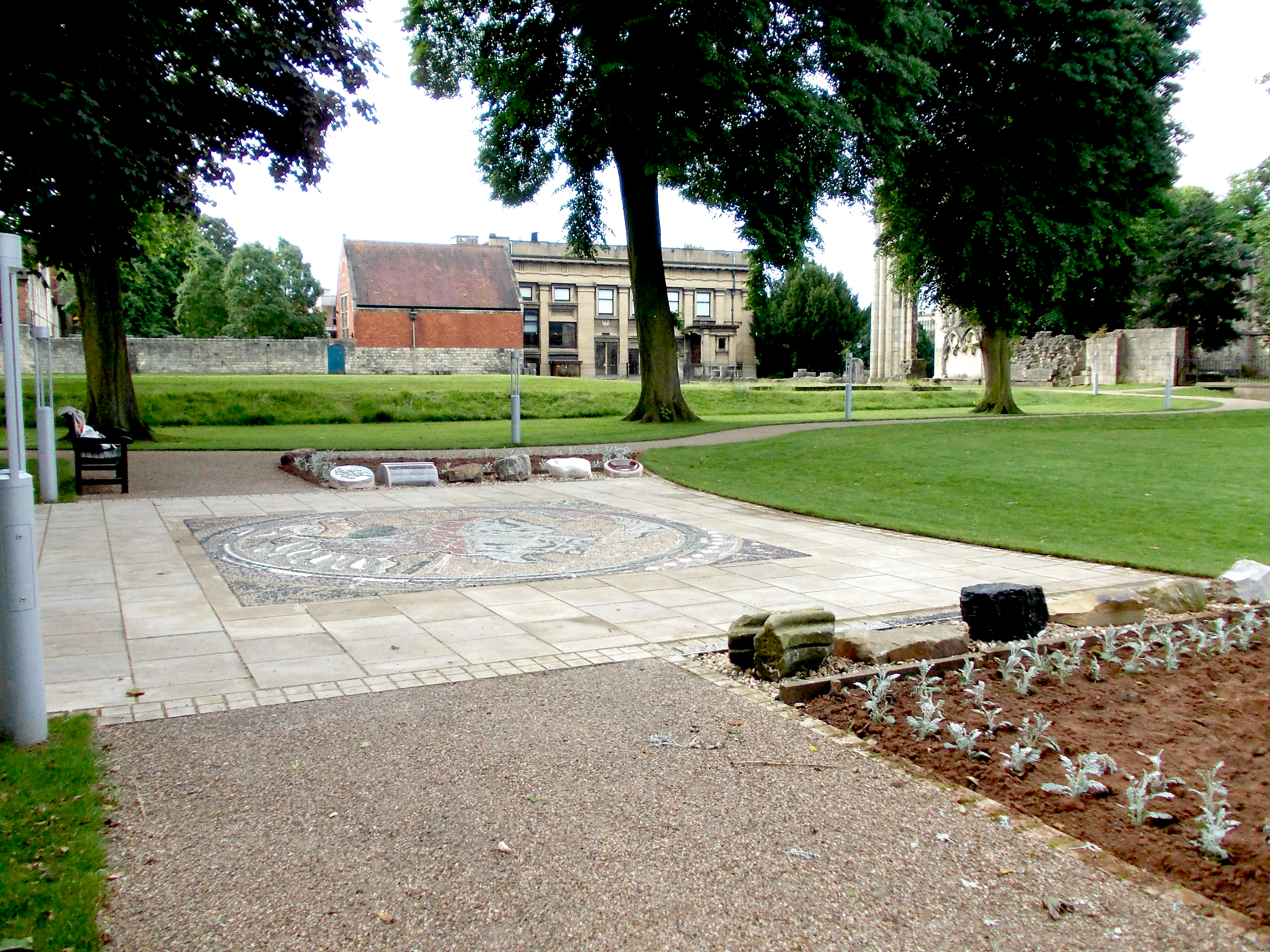
Geological map – Final samples in place
The installation of the William Smith Geological Map mosaic was completed last week with the positioning of the final rock samples in front of the surrounding flower borders.
The last samples were two of the clays, representing Smith’s Red Marl and Clay with Sand and Gravel. Earlier this year,they had been fired into attractive and interesting ceramics by ‘Potter Man’ – Lee Steele, but before they could be put in place, they needed to be set in protective concrete plinths. This has now been done, and you can see a table giving information about all our rock samples by clicking here:-Draft Rock leaflet, June 27
These pictures show the final samples; Triassic Red Clay, from Alne Brickworks represents Smith’s Red Marl, and Boulder Clay from Mappleton, Holdern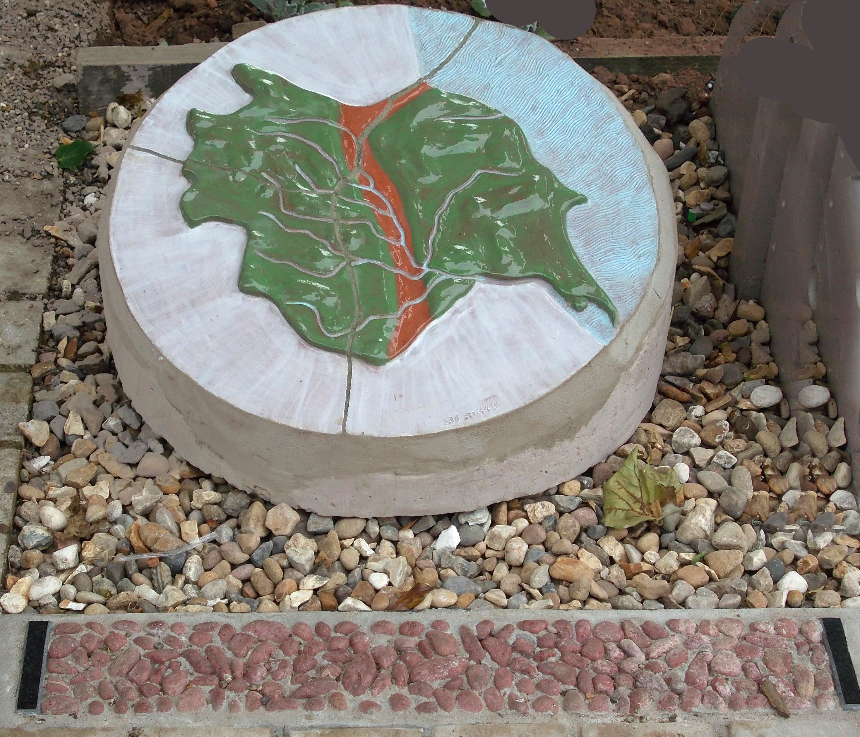 ess represents Clay with Sand and Gravel. The Red Marl was fashioned into a map of Yorkshire, in which the appropriate area has been given a clear glaze, showing the natural colour of the clay after firing, and the Holderness C
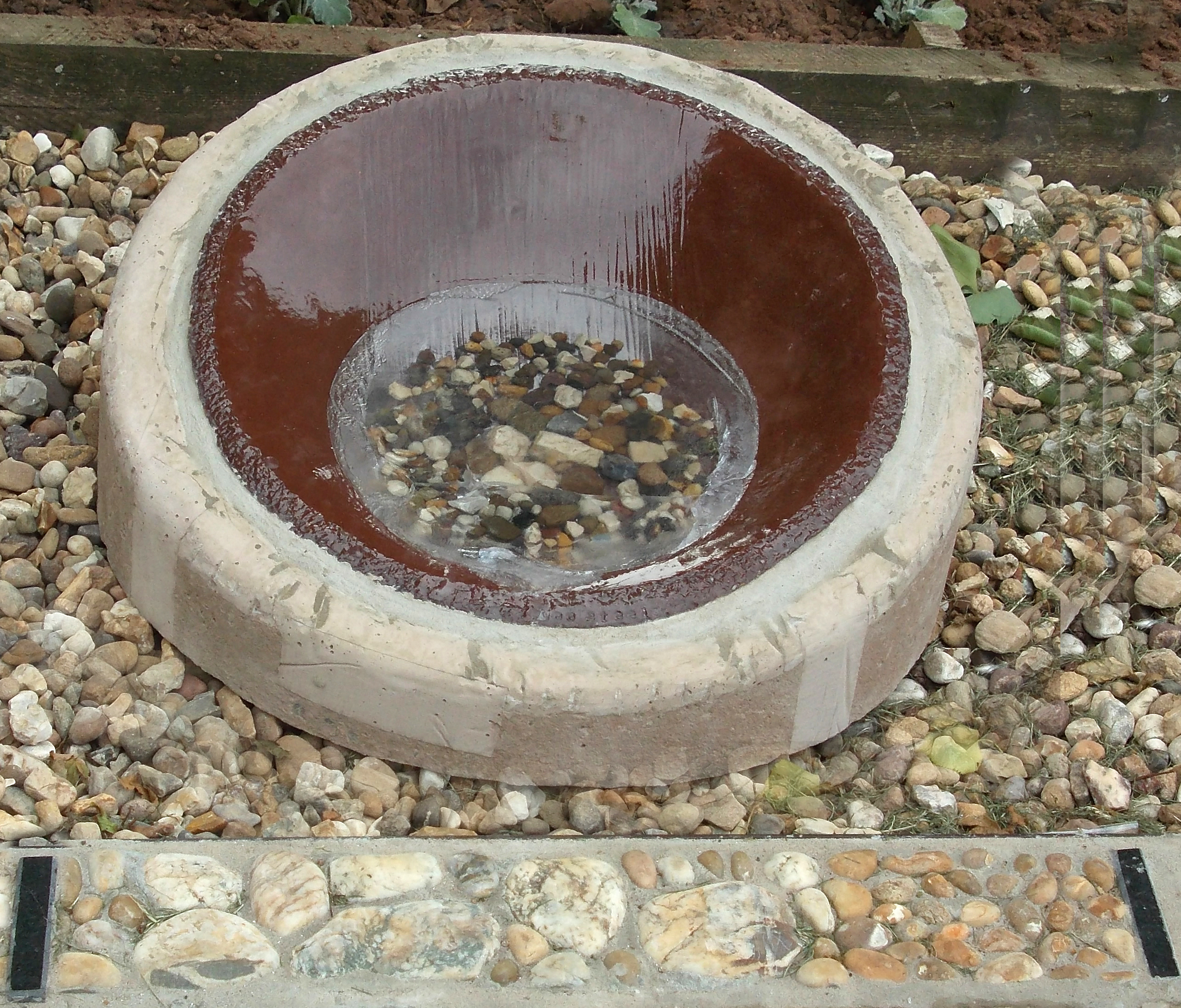 lay was sieved and made into a bowl, which contains the stones removed by the sieve, set in clear resin, representing the glacier which carried and deposited the material.
Click on this link to learn more about the Geological Map Project.