Yorkshire Geology
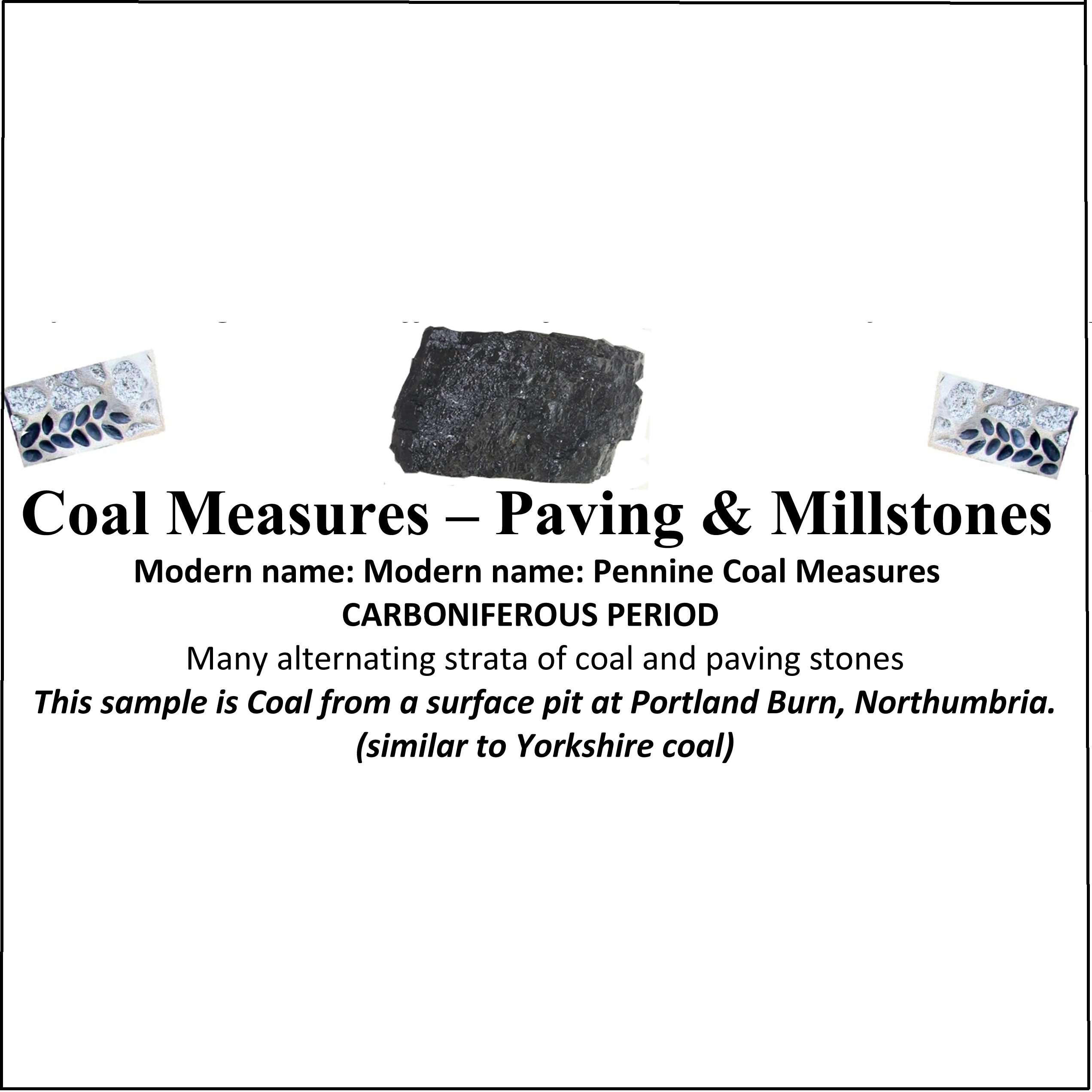
One of the aims of the Geological Map Project was to provide an introduction to the geology of Yorkshire. The mosaic map introduces many ideas, particularly Smith’s message about how the rocks had been laid down in strata which could be identified by the fossils they contain. However, necessarily, the pebbles in the mosaic were chosen to reflect the colours Smith used in his map, not the appearance of the actual rocks.To demonstrate what the real Yorkshire rocks look like, we have collected samples of rock from sites identified by Smith throughout the county. These are now displayed in the flower beds on either side of the mosaic, illustrating the strata in order of deposition .
It was not easy to decide on suitable representative specimens. As Smith was working alone, and often had to deduce structures that were hidden under superficial deposits, his map was not always totally consistent with modern knowledge. Smith recognised these limitations, and continued to make improvements to the work. This was continued by many later geologists, who have also changed the names of rock types many times. We eventually decided to choose a specimen from each geological area shown in the 1815 map, even where Smiths 1815 name did not exactly match modern interpretations. To compound the problem, large specimens of coal and clunch clay are not now readily obtainable in the exact areas shown by Smith, so specimens from geologically similar formations were obtained from elsewhere. In North Yorkshire, Smiths clunch clay and shale corresponds mainly to Redcar mudstone from the lower Jurassic lias. Most of the Redcar mudstone is friable shale, so we have selected a particularly hard siliceous stratum that will better resist weathering. Confusingly, Smith has used the term clunch clay in other parts of the country to describe Oxford clay from the upper Jurassic.
Collecting the specimens presented more problems, but with the advice of many geologists and and the help of Geoff Hutchinson of the YMT, a number of quarry managers, and a several YPS members, we now have a complete set.
Samples from areas described by Smith as ‘Red Marl’ and ‘clay with sand and gravel’ have presented other problems, as untreated specimens would have weathered rapidly. “Potter Man”, Lee Steele, has been able to treat and fire these samples in a creative way, but although he has used a clear glaze, the colour of the clay has, of course, changed in firing.
To download a table giving modern names as well as those used by Smith, and information on where our samples were obtained, click here:Draft Rock leaflet, June 27
To find more about Yorkshire geology, the following may help:-
Further Reading
A superb introduction for children and non-technical adults:
Bell, Richard: Yorkshire rock: a journey through time. Nottingham: British Geological Survey, 1996
Equally accessible:
Osborne, Roger: Rocks and landscape of the North York Moors. Helmsley: North York Moors National Park Authority, 2010
Slightly more serious, but in an easily readable narrative style is Ensom, Paul: Yorkshire geology. Wimborne Minster: Dovecot Press, 2009
The best website for easily accessible detailed information is www.bgs.ac.uk. Of particular interest is the BGS ‘Geology of Britain Viewer’
http://mapapps.bgs.ac.uk/geologyofbritain/home.html
which also allows you to change base map and flip between the WS 1815 map and a modern geological map. .
Liam Herringshaw’s website fossilhub.org contains a wealth of eclectic information, mostly based on lectures he has given. Look for York-a-rocky-history